| HOME-PAGE | HISTORY | GEOGRAPHY | WIRIKUTA | MAPS |
| INFORMATION | PHOTO-TOUR | CONTACT |
Basic Information:
|
 © 2005, Jesús Cabral |
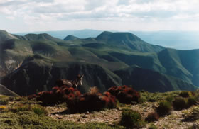
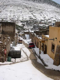
The region of Catorce comprises highlands and lowlands. The first is a compact and tall mountain mass that could fit into a square 15 x 30 mi. In its southern portion you can find woodlands -oak, pine, cypress and "madroño" (looks like the Californian manzanita). The northernmost areas are treeless. The reason for this rather irregular forestation is that the old and once prosperous mining town of Real de Catorce is located in the northern portion of the sierra and mining operations relied on steam power fueled by wood stripped from this once wooded northern area.
|
 © 2005, Valerio Monti |
It is interesting to note that as early as 1828 people were concerned about how fast the hills here were becoming deforested... but nobody could stop it... just as now nobody seems to be able to halt pollution! But we are fortunate to find xxx beautiful woods in the southern area of the sierra... A walk of a day or two to the south provides an enjoyable way to experience this natural beauty. The flora, mainly cactuses and perfumed bushes, nevertheless are very interesting in this northern portion .
|
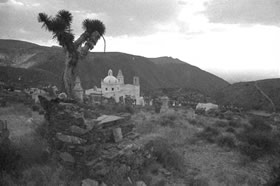 © 2005, Pedro Tzontémoc |
The lowlands are typical Chihuahuan desert lands. Mesquite trees are found here and there, and different cactuses abound. Joshua trees add a distinctive look. All in all Real enjoys a wonderful setting that continues for hundreds of miles. The Chihuahuan desert is incredibly vast extending from Oaxaca, northward through Puebla, Tlaxcala, Hidalgo , Queretaro and on to Zacatecas and San Luis Potosi opening onto the northern plateau that stretches north to the Four Corners, through northern Mexico and the American Southwest.
|
 © 2005, Valerio Monti |
 |
|
|
|
|